Our Services

We provide the following services for our clients.
- Construction Layouts
- Existing Conditions Surveys
- Boundary Retracement Surveys
- Approval not Required (ANR) Plans
- Easement Surveys
- ALTA/ACSM Land Title Surveys
Why use Reed Land Surveying, Inc. for these services?
- Experienced staff
- Latest technology
- Product delivered on time
- High quality at a fair cost
- Drawing can be customized to meet client’s drafting standards
- Familiar with the ALTA/ACSM Land Title Survey specifications and requirements
- Experienced in communicating with legal counsel regarding the survey product and any “issues” that are discovered in the course of the survey
Construction Layout Services
- Building layout
- Site layout
- Utility layout
- As-built surveys
- Safety trained crews
- Field Crew can be scheduled with 24-48 hour notice
Reed Land Surveying, Inc. is dedicated to providing quality Construction Layout and Land Surveying services to clients in the eastern Massachusetts area. We have the knowledge and experience to layout your proposed building. We know and understand the importance of being able to provided services when you need them and keep your project on track to meet your deadlines.
Construction Layout Procedures
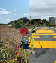
When you retain our services for your project we request a full set of drawings and any CAD design files that are available for the project from you. Once we have the plans we review the plans and perform the necessary calculations to be sure all the dimensions shown will work and will “close” mathematically. If we discover problems we will write up a request for information (RFI) to get clarification and to document any discrepancies. We know the importance of a good “paper trail” and proper lines of communication on your project. Once we have resolved any issues we find in the plans: we can then mobilize our crew into the field to layout the proposed improvements. We communicate with you to before we proceed to the job site to determine what you would like set for control points. This allows us to precalulate any offsets you want before we go to the site to avoid on site field calculations. We then upload a computer file into our data collectors (hand held field computers) before we go to your site. When we get a job site we come equipped with a robotic total station, a data collector, and a digital level to provide efficient and accurate layout by our field crew. After we stake out you project we return to our office and promptly provide a control sketch depicting the points we set for you using AutoCAD. We can convert AutoCAD drawings to PDF files to enable transfer of drawings and sketches to anyone involved in the project that does not have AutoCAD. Upon completion of your project we can provide the as-built surveys you need. We can provide the construction layout services you need for any project you are building in eastern Massachusetts.
Existing Conditions Surveys:
An existing conditions survey consists of the integration of a boundary retracement survey, resource area mapping (wetlands, riverfront areas, and flood zones), a utility survey, and a topographic survey into one survey plan. These plans are used by design professionals as a base map for their design. Typical clients include architects, civil engineers, developers, homeowners and landscape architects.
Boundary Retracement Surveys:
A boundary retracement survey consists of research at the municipal offices and at the registry of deeds, survey calculations, data reduction, field reconnaissance, field measurements, and analysis necessary to render an opinion regarding the location of the existing boundary lines of the parcels of land. The measurements for the survey are made on the ground with survey instruments. Typically iron rods are set at the corners of the property and the lines between the corners are marked with wooden stakes. A plan can be prepared to depict the results of the survey that can be recorded at a registry of deeds. Developers, homeowners and commercial land owners are typical clients.
Approval Not Required Plans:
An Approval Not Required Plan is a plan created to divide land on existing ways. These plans are prepared after a boundary retracement survey has been performed to render an opinion of where existing boundaries of a parcel of land.
Easement Surveys:
An easement is an interest in a property that grants a right of use to another person (easement in gross) or that benefits another property (appurtenant easement). Easement plans are used to describe the portion of a property subject to an easement and to enable a land surveyor to mark the location of an easement on the ground. Easements can be for many purposes, some typical examples are:
- Access easements
- Drainage easements
- Driveway easements
- Exclusive use easements
- Flowage easements
- Light and air easements
- Right of ways
- Utility easements
- View Easements
- Water easements
ALTA/ACSM Land Title Surveys:
An ALTA/ACSM (American Land Title Association and American Congress on Surveying and Mapping) Land Title Survey is a boundary retracement survey with a plan prepared depicting specific features (buildings, parking, etc.) and encroachments on the property. These plans are used by owners, title insurance companies, and banks in preparing title insurance policies that are issued for commercial properties.